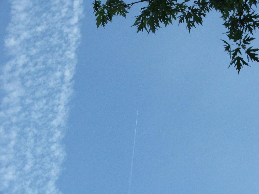
Grey Skies, in About an Hour
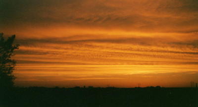
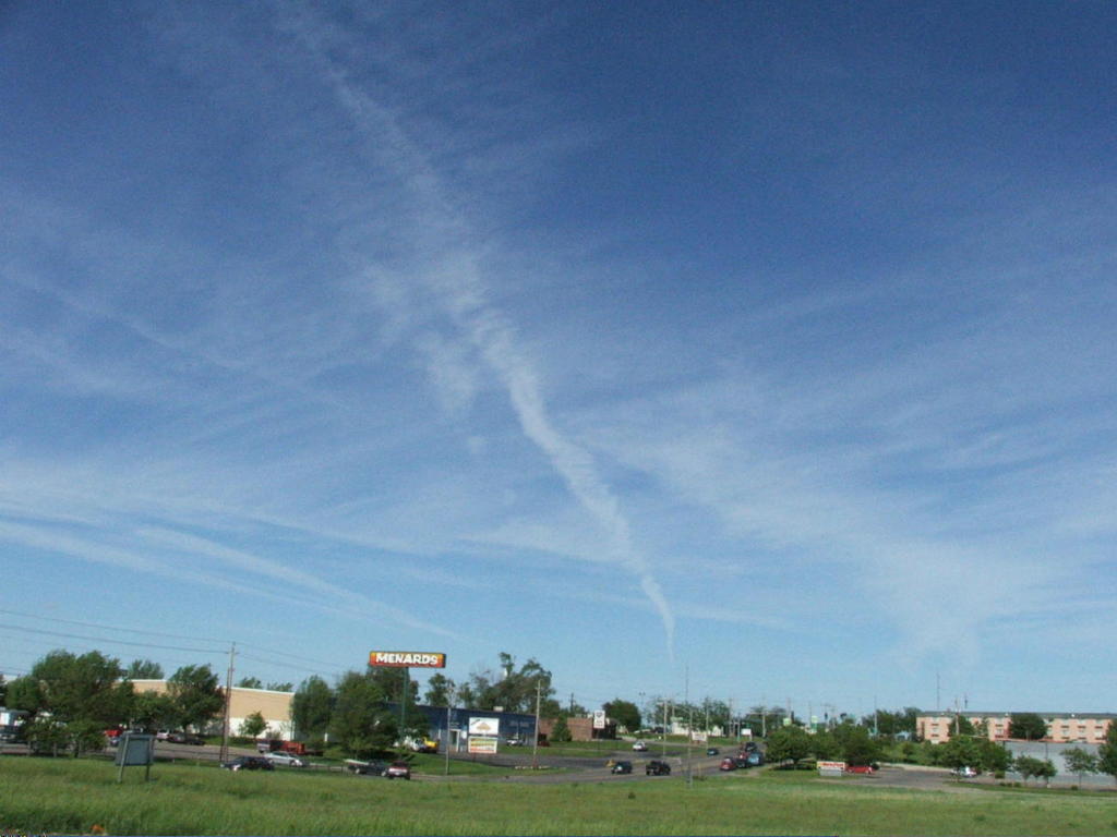
This day, Monday, September 12, 2005, the skies over Eastern Iowa were very smoggy, as they were on Sunday.
I'm surprised there wasn't a pollution warning, as there have been several this year. Once winter comes, I imagine we'll see more smoggy days.
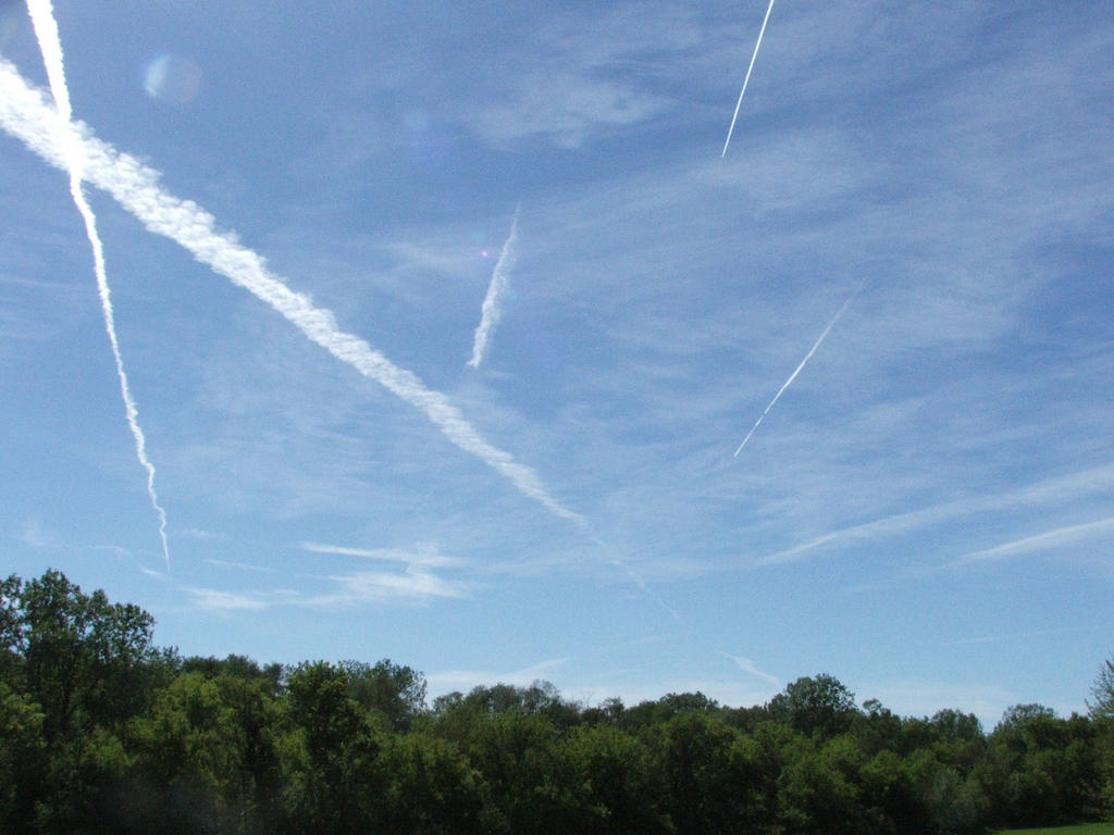
Despite the smoggy skies, I saw numerous curious chemtrails, a few in Clinton which were white enough to stand out against the grayness and quite many obvious signs of aerial activity between Tipton and IA City as the sun was setting.
Following is the current archive of Iowa Skies photos and commentary.

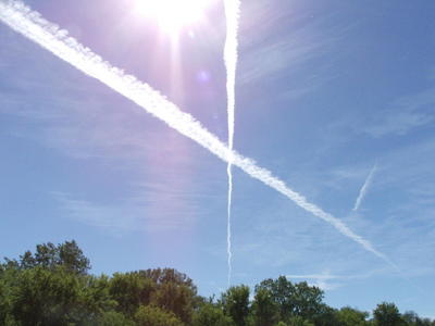
These images were taken about one hour apart. They display the skies over DeWitt, Iowa on a weekday morning in July 2005.
Following is a chronological presentation of the plane and cloud activity during that hour which shows the progression of chemtrail/aerosol operations.
Even if we assume these are normal planes and normal exhaust from jet engines flying at very high altitudes, surely the extreme pollution which is visible is cause for alarm.
Click on images for larger, more detailed picture

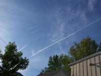
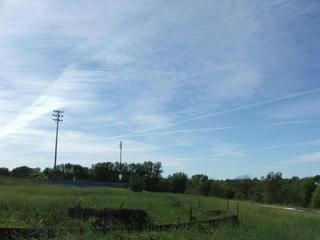
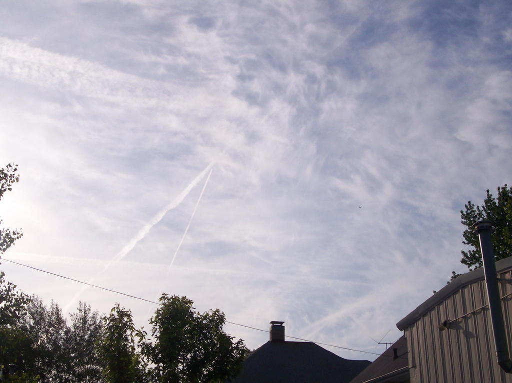
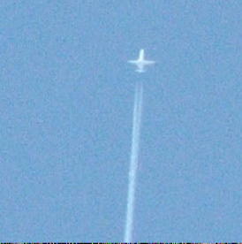
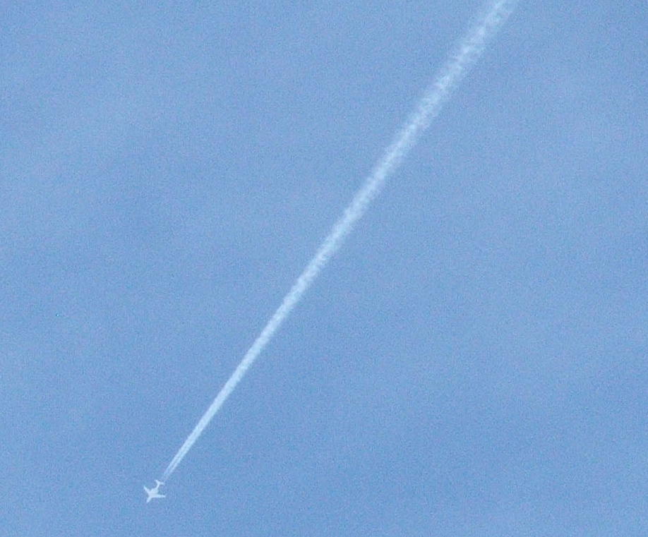
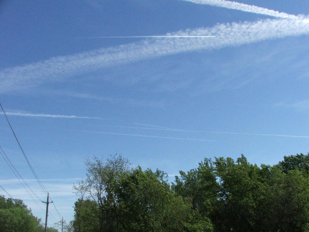
Two trails and some “cloud” wisps in the sky. The plane leaving the top trail is flying parallel to his little neighbor below.

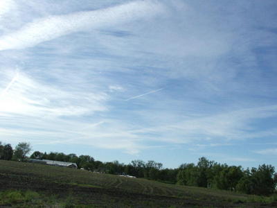
The two trails are spreading out.
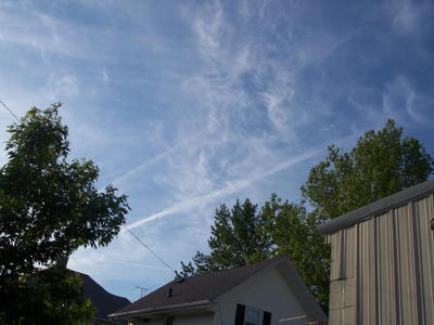
The spread continues.
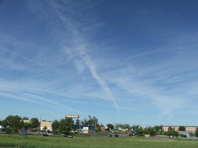
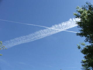
If you look closely at the smoggy mess which has become the sky, you can see a plane leaving a trail more-or-less perpendicular to the trails in the first image. The trail follows the power line and the plane is above the chimney.

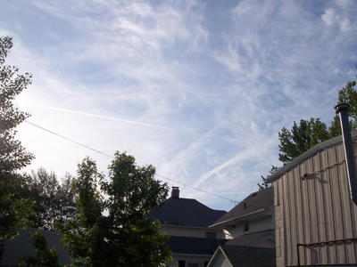
Same plane and trail, a few moments later.

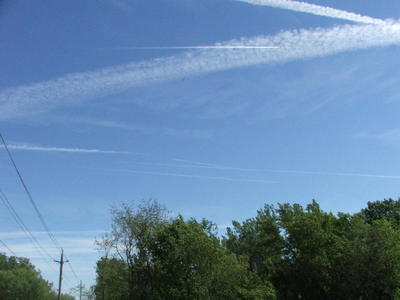
Another plane visible in lower left above tree.
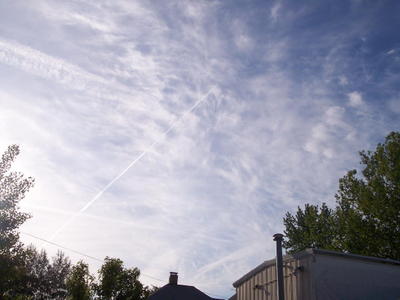
Same plane is now clearly visible as it crosses the sky.

Another plane is about to cross the trail from the above image.

Final shot in this progression, shown in introduction. This is what a chemtrail sky looks like after an hour.
Observations from a skywatcher:
Since the fateful May afternoon when I took my first photos of this strange activity in the sky, I have been researching the phenomenon and watching the skies religiously.
I have the privilege of daily viewing the skies over the Quad-City region, home to the Moline Airport and the Rock Island Arsenal. The Arsenal is to my understanding the largest military facility of its kind, producing things like add-on armor for Humvees, Howitzer machine guns and who knows what else. It is frequently said around here that the Rock Island Arsenal was and is an initial target of Russian nukes in the event of a conflict.
I also have the privilege of watching the skies over the DeWitt region to the north, and the Clinton area to the northeast. Clinton sits across the river from the Cordova nuclear power plant. Between Davenport and DeWitt lies the Mt. Joy National Guard installation, where Chinook helicopter training is conducted.
Furthermore, I have a reliable skywatcher contact in the Des Moines area (home to many important facilities and corporations) who provides a near-daily update.
It is also important to recognize there are several nuclear waste storage sites in Iowa. Whether such facilities and the above mentioned military and nuclear hubs are related to the chemtrail phenomena is unclear, but it helps to remind us Iowans that we are not the “middle of nowhere” as we sometimes imagine. Another fact to keep in mind is how important Midwest agriculture is to the food and feed supply of this nation and the world.
Since May I have consistently observed high-altitude planes leaving obvious chemtrails over eastern Iowa on average 5 out of 7 days each week. They do seem to take breaks every once in a while. My reports from the D.M. area seem to run concurrent with eastern Iowa activity; in other words, if the skies are clear here, they are clear there; and if the planes are at work in one spot, they’re working in the other.
When there are chemtrails over Davenport, there are chemtrails over DeWitt, chemtrails over Clinton, and in fact, chemtrails as far as the eye can see. I’d love to one of these days, when activity is high, drive across the state, from east to west to north and south, and see what I can see.
Some days, I get the pleasure of seeing a jet leaving a “normal contrail,” one which is relatively short in length and dissipates without leaving a muddy mess in the sky, one which is left by an obvious passenger plane and is not followed by other unmarked planes leaving long expanding trails which parallel and intersect each other in distinct geometric patterns.
On those days, especially when the “normal contrail” appears at the same time the cloud-monsters are at work, I can be confident I’m not just paranoid and conspiratorial.
I can’t say with any authority the purposes and mechanisms behind the aerosol operations in our skies.
I could say a lot about the various theories and my opinions of them, but I’d like to stick with what I know.
I know there are planes flying over Iowa at very high altitudes which leave long trails in apparent geometric patterns which over time expand and fill the sky.
I’m convinced from my observations of these planes they are not commercial passenger jets. I’m also convinced what they are doing is deliberate.
I discern the insulated skies which result from activity such as shown in the photos above will and does lead to diminished sunlight reaching the lower atmosphere and likely will result in subsequent environmental consequences, regardless of the phenomena’s origin, purpose or cause.
That’s enough gong fu for now.
I will leave you with a final image.
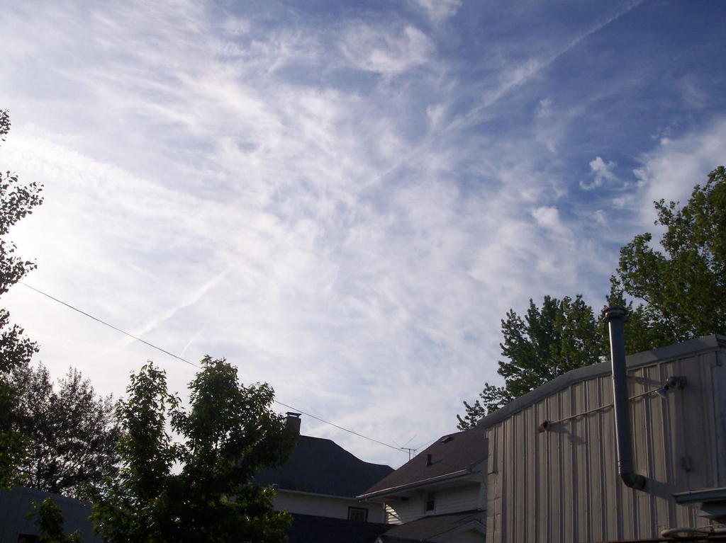
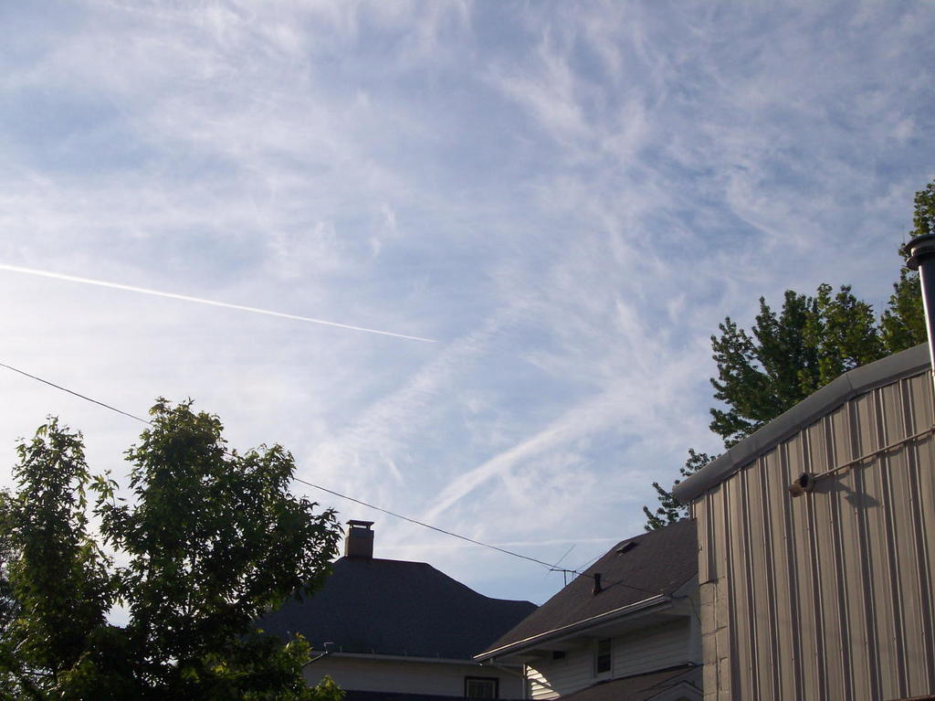
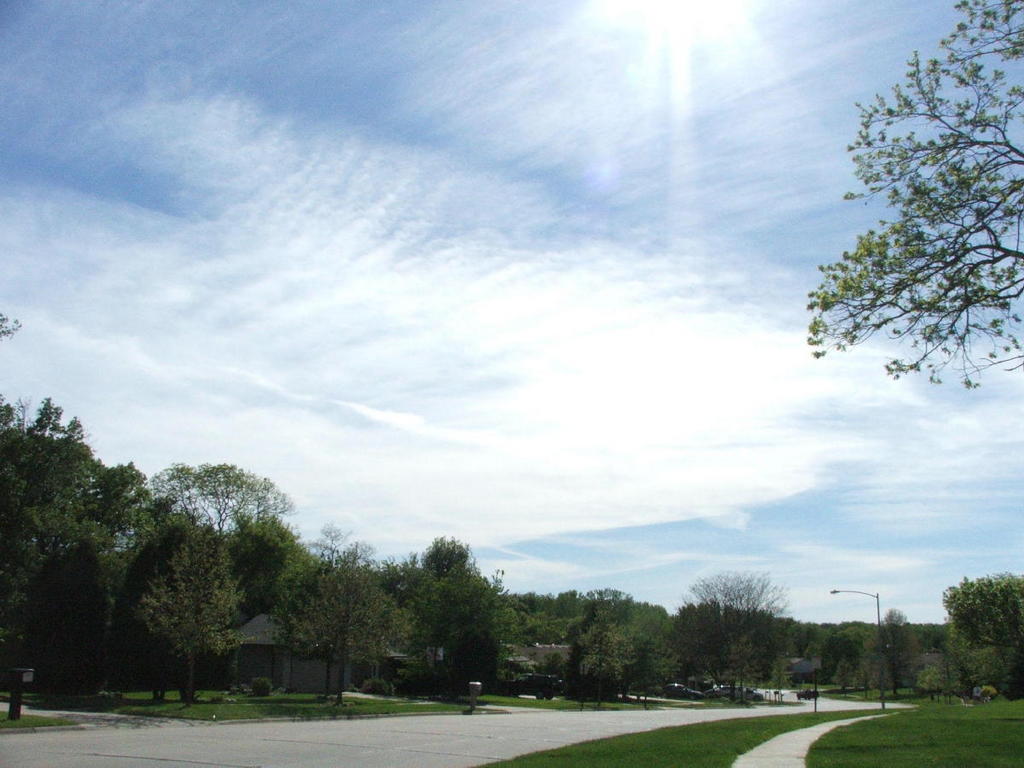
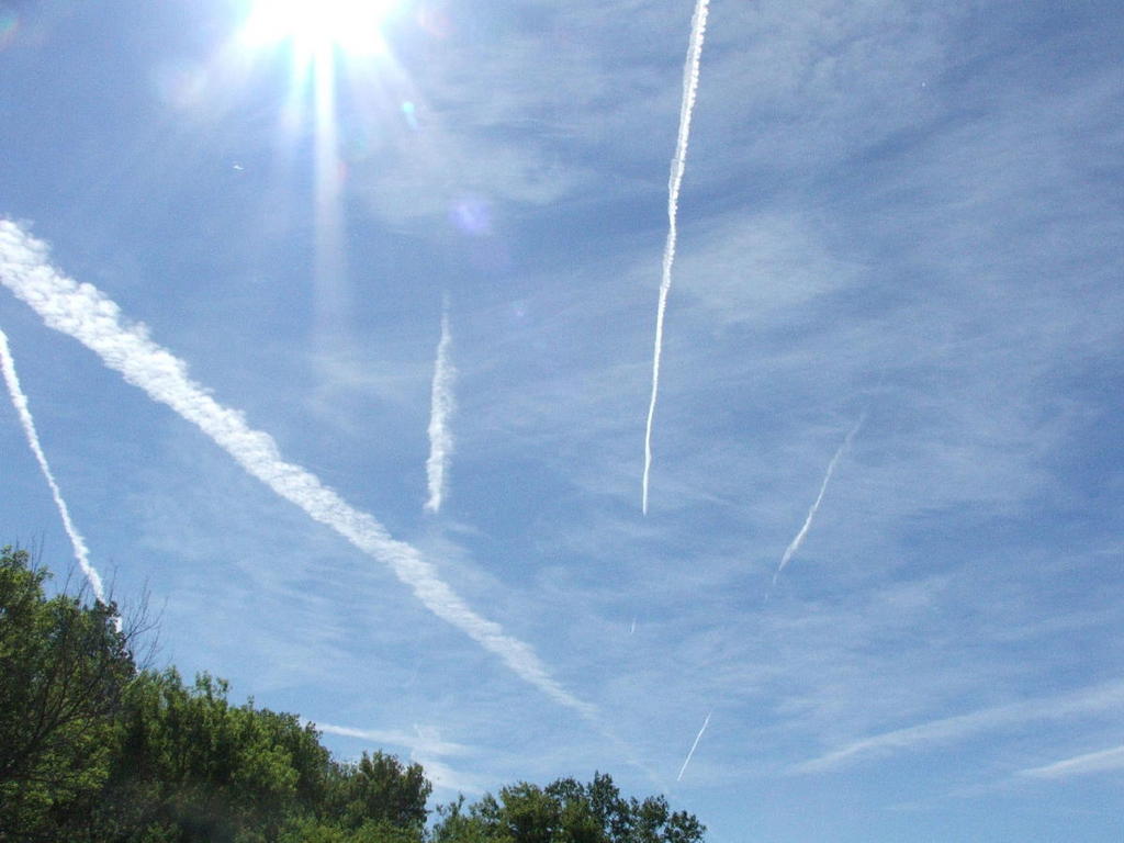
This picture was taken from the other side of the building featured in the above montage. It was taken in the late evening a day or two before the photos featured above. DeWitt, Iowa, with a population of approximately 5,000 and located in a rural community, sure is a hotspot for air traffic.

DeWitt, Iowa
June 2005
If you want to hide something, put it in plain view.
For a brief introduction to "chemtrails" or "aerosol trails" see my previous post Worth a Thousand Words at
http://www.menatlgongfu.blogspot.com
Davenport, Iowa May 22, 2005
from the Green Space in northwest Davenport.
Just a few minutes later, from a different angle:.

from a field off Northwest Boulevard looking northwest:
from Kwik Shop on 53rd Street near North High School, looking northeast:
from my backyard. This picture helps to put it in perspective. A plane in progress of leaving a trail next to one which has been around for a while.

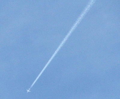
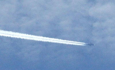
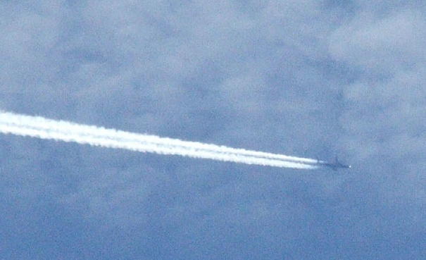
a close-up of a plane:

from an industrial site on North Carey, looking north toward Mt. Joy area over a baseball field:
Another good comparison:
Another plane close up:
A view of the Green Space from a few blocks away. This looks in the same general direction as the previous Green Space photos but was taken about one block further north on Marquette Street:

Is it sinking in yet?
Zooming in:
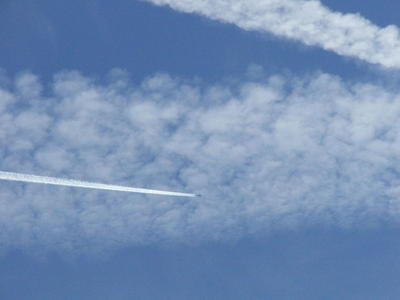
Another plane close up:
The overall picture again:

Look up. Look to the skies. Watch the planes and the weather. The operations continue.
I'm surprised there wasn't a pollution warning, as there have been several this year. Once winter comes, I imagine we'll see more smoggy days.
Despite the smoggy skies, I saw numerous curious chemtrails, a few in Clinton which were white enough to stand out against the grayness and quite many obvious signs of aerial activity between Tipton and IA City as the sun was setting.
Following is the current archive of Iowa Skies photos and commentary.

These images were taken about one hour apart. They display the skies over DeWitt, Iowa on a weekday morning in July 2005.
Following is a chronological presentation of the plane and cloud activity during that hour which shows the progression of chemtrail/aerosol operations.
Even if we assume these are normal planes and normal exhaust from jet engines flying at very high altitudes, surely the extreme pollution which is visible is cause for alarm.
Click on images for larger, more detailed picture

Two trails and some “cloud” wisps in the sky. The plane leaving the top trail is flying parallel to his little neighbor below.

The two trails are spreading out.

The spread continues.

If you look closely at the smoggy mess which has become the sky, you can see a plane leaving a trail more-or-less perpendicular to the trails in the first image. The trail follows the power line and the plane is above the chimney.
Same plane and trail, a few moments later.

Another plane visible in lower left above tree.

Same plane is now clearly visible as it crosses the sky.
Another plane is about to cross the trail from the above image.

Final shot in this progression, shown in introduction. This is what a chemtrail sky looks like after an hour.
Observations from a skywatcher:
Since the fateful May afternoon when I took my first photos of this strange activity in the sky, I have been researching the phenomenon and watching the skies religiously.
I have the privilege of daily viewing the skies over the Quad-City region, home to the Moline Airport and the Rock Island Arsenal. The Arsenal is to my understanding the largest military facility of its kind, producing things like add-on armor for Humvees, Howitzer machine guns and who knows what else. It is frequently said around here that the Rock Island Arsenal was and is an initial target of Russian nukes in the event of a conflict.
I also have the privilege of watching the skies over the DeWitt region to the north, and the Clinton area to the northeast. Clinton sits across the river from the Cordova nuclear power plant. Between Davenport and DeWitt lies the Mt. Joy National Guard installation, where Chinook helicopter training is conducted.
Furthermore, I have a reliable skywatcher contact in the Des Moines area (home to many important facilities and corporations) who provides a near-daily update.
It is also important to recognize there are several nuclear waste storage sites in Iowa. Whether such facilities and the above mentioned military and nuclear hubs are related to the chemtrail phenomena is unclear, but it helps to remind us Iowans that we are not the “middle of nowhere” as we sometimes imagine. Another fact to keep in mind is how important Midwest agriculture is to the food and feed supply of this nation and the world.
Since May I have consistently observed high-altitude planes leaving obvious chemtrails over eastern Iowa on average 5 out of 7 days each week. They do seem to take breaks every once in a while. My reports from the D.M. area seem to run concurrent with eastern Iowa activity; in other words, if the skies are clear here, they are clear there; and if the planes are at work in one spot, they’re working in the other.
When there are chemtrails over Davenport, there are chemtrails over DeWitt, chemtrails over Clinton, and in fact, chemtrails as far as the eye can see. I’d love to one of these days, when activity is high, drive across the state, from east to west to north and south, and see what I can see.
Some days, I get the pleasure of seeing a jet leaving a “normal contrail,” one which is relatively short in length and dissipates without leaving a muddy mess in the sky, one which is left by an obvious passenger plane and is not followed by other unmarked planes leaving long expanding trails which parallel and intersect each other in distinct geometric patterns.
On those days, especially when the “normal contrail” appears at the same time the cloud-monsters are at work, I can be confident I’m not just paranoid and conspiratorial.
I can’t say with any authority the purposes and mechanisms behind the aerosol operations in our skies.
I could say a lot about the various theories and my opinions of them, but I’d like to stick with what I know.
I know there are planes flying over Iowa at very high altitudes which leave long trails in apparent geometric patterns which over time expand and fill the sky.
I’m convinced from my observations of these planes they are not commercial passenger jets. I’m also convinced what they are doing is deliberate.
I discern the insulated skies which result from activity such as shown in the photos above will and does lead to diminished sunlight reaching the lower atmosphere and likely will result in subsequent environmental consequences, regardless of the phenomena’s origin, purpose or cause.
That’s enough gong fu for now.
I will leave you with a final image.
This picture was taken from the other side of the building featured in the above montage. It was taken in the late evening a day or two before the photos featured above. DeWitt, Iowa, with a population of approximately 5,000 and located in a rural community, sure is a hotspot for air traffic.
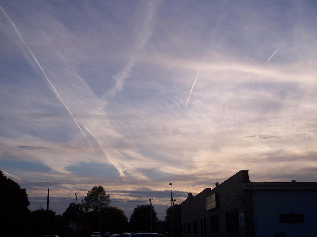

DeWitt, Iowa
June 2005
If you want to hide something, put it in plain view.
For a brief introduction to "chemtrails" or "aerosol trails" see my previous post Worth a Thousand Words at
http://www.menatlgongfu.blogspot.com
Davenport, Iowa May 22, 2005
from the Green Space in northwest Davenport.

Just a few minutes later, from a different angle:.
from a field off Northwest Boulevard looking northwest:

from Kwik Shop on 53rd Street near North High School, looking northeast:
from my backyard. This picture helps to put it in perspective. A plane in progress of leaving a trail next to one which has been around for a while.
a close-up of a plane:
from an industrial site on North Carey, looking north toward Mt. Joy area over a baseball field:

Another good comparison:

Another plane close up:
A view of the Green Space from a few blocks away. This looks in the same general direction as the previous Green Space photos but was taken about one block further north on Marquette Street:
Is it sinking in yet?
Zooming in:

Another plane close up:
The overall picture again:
Look up. Look to the skies. Watch the planes and the weather. The operations continue.
posted by Mentalgongfu at 9:14 PM
![]()

1 Comments:
If you had financial problems, then it is time for you to smile. You only need to contact Mr. Benjamin with the amount you wish to borrow at the low rate of 2% ROI and the payment period that suits you and you will have your loan within three working days. I just benefited for the sixth time from a loan of 700 thousand dollars for a period of 180 months with the possibility of paying before the expiration date. Mr Benjamin has been helping me with the loan.Make contact with him and you will see that he is a very honest man with a good heart.His email is 247officedept@gmail.com and his WhatApp phone number is + 1-989-394-3740 .
Post a Comment
<< Home